Transit & getting around
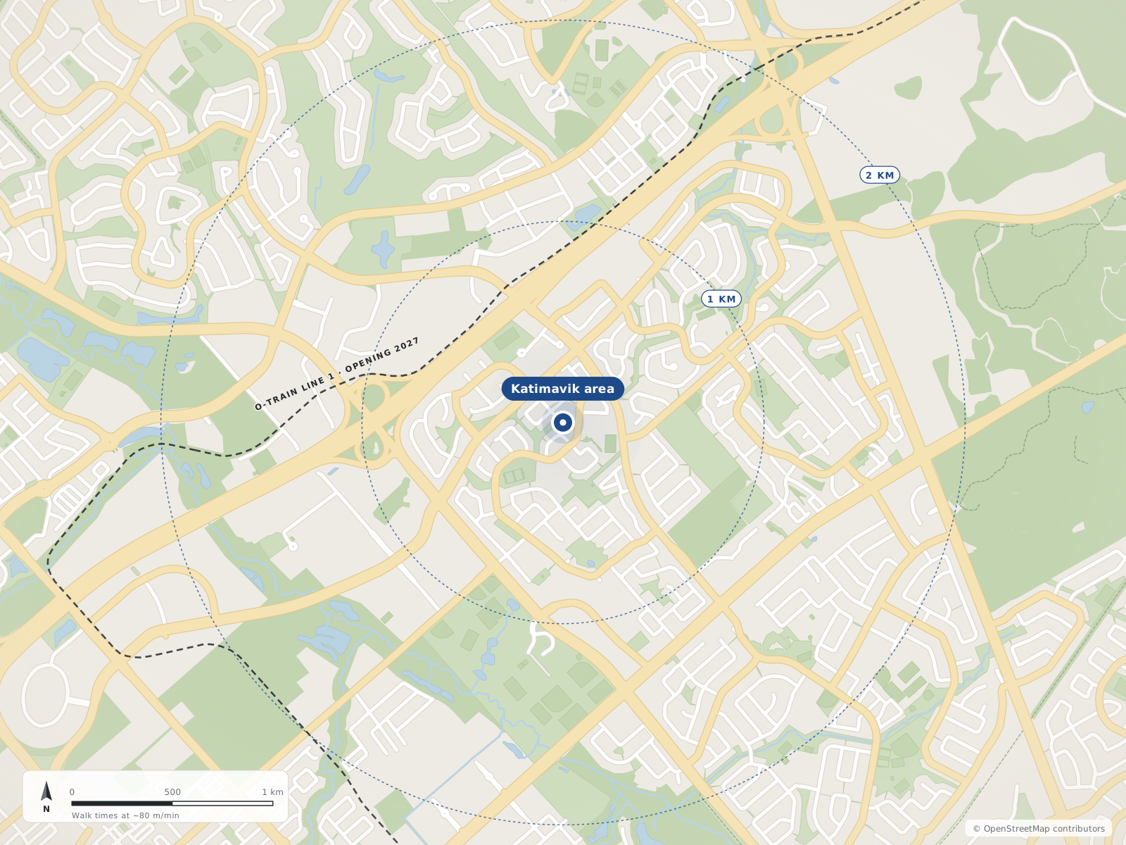
Katimavik-Hazeldean sits beside Highway 417, about 20 km in a straight line from Parliament Hill.
The O-Train does not run through the Katimavik area yet: Moodie, just east, is the western end of Line 1.
Updated · Facts on this page link to their sources
Wikipedia notes three Highway 417 exits serving the area: Eagleson Road, Castlefrank Road/Kanata Avenue and Terry Fox Drive. In the 2021 census, 82.6% of workers here commuted by car and 6.8% by public transit; 44.2% worked at home (Ottawa Neighbourhood Study).
OC Transpo bus routes change, so check current service at octranspo.com. The O-Train station in our place list, Moodie, is on the Confederation Line.
Drive times
From the area centre. Straight-line distance from the area centre; driving distance and free-flow time from the OSRM demo router on OpenStreetMap roads (no traffic).
Parliament Hill (downtown Ottawa)
23.1 km by roadrouter.project-osrm.org
21 minby car
Transit and routes
O-Train stations
1Moodie
Confederation Line
Quick answers
Short answers first; each links to the full answer and its sources.
How far is Katimavik from downtown Ottawa?
From the centre of Katimavik, Parliament Hill is about 20.3 km in a straight line and 23.1 km by road. The drive is about 21 minutes in free-flowing traffic.
As of 2026-10 · router.project-osrm.org openstreetmap.org
What is the nearest O-Train station to Katimavik?
Moodie, on the Confederation Line (O-Train Line 1), is the only O-Train station in our data for the area, and it is open. It is about 6 km in a straight line from the centre of Katimavik, calculated from OpenStreetMap coordinates.
As of 2026-10 · openstreetmap.org en.wikipedia.org
Which OC Transpo bus routes serve Katimavik?
Wikipedia lists Route 257 as the main service, running peak-times only to downtown and Eagleson Station along Castlefrank Road and Katimavik Road. It also lists route 88 on Hazeldean Road and Terry Fox Drive, route 164 on Eagleson Road, all-day express routes 61 and 62, and limited local service on 161 and 168.
As of 2026-10 · en.wikipedia.org ons-sqo.ca
How do people in Katimavik get to work?
In the 2021 census, 82.6% of Katimavik-Hazeldean workers commuted by car, truck or van and 6.8% by public transit. 44.2% worked at home.
As of 2021 · ons-sqo.ca
How easy is it to get on Highway 417 from Katimavik?
Wikipedia says three Highway 417 exits serve the area: 138 (Eagleson Road), 139 (Castlefrank Road/Kanata Avenue, a half-interchange) and 140 (Terry Fox Drive). The highway forms the neighbourhood's northern boundary.
As of 2026-10 · en.wikipedia.org router.project-osrm.org
Do many people in Katimavik work from home?
In the 2021 census, 44.2% of Katimavik-Hazeldean workers worked at home. 82.6% of workers who commuted used a car, truck or van, and 6.8% used public transit.
As of 2021 · ons-sqo.ca